Warning signs[edit]
The importance of a warning sign is emphasised by the red border around its edge and the triangular shape. Some warning signs do not have a red border like sharp deviation. The priority of traffic through the junction is indicated by the broader line. Examples below exclude low bridges, railway and tramway level crossings, bus and pedal cycle facilities, traffic calming and road works.
Plate use with "STOP" triangle to give the distance to STOP line
Plate used with "GIVE WAY" sign to give the distance to GIVE WAY line
Plate used with "traffic signals" for traffic signals that operate only at certain times
Traffic merges from the left
Traffic merges onto the main carriageway
Bend to right (left if symbol reversed)
Double bend first to the left (right if symbol reversed)
Junction on a bend (symbols may be reversed)
Junction on a bend (symbols may be reversed)
Plate used with "roundabout" or "bend" signs
Sharp deviation of route to the left (right if chevrons reversed)
Plate used with warning signs where a reduction in speed is necessary
Advisory speed limit in miles per hour
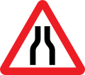
Road narrows on both sides
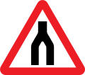
Road narrows on right (left if symbol reversed)
Oncoming traffic will be in the middle of the road
Single file traffic in each direction
Road wide enough for only one line of vehicles
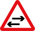
Two-way traffic on route crossing ahead
Worded warning "Ford" may be varied to "Flood", "Gate", "Gates" or "No smoking"
Try brakes after crossing a ford or before descending a steep hill
Steep hill downwards (10% is equivalent to 1:10)
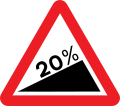
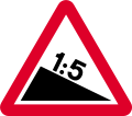
Steep hill upwards (20% is equivalent to 1:5)
Plates used with "steep hill" signs
Plates used with "steep hill" signs
Plates used with "steep hill" signs
Water course alongside road
Plate used with "soft verges" for distance shown
Distance and direction to hazard
Distance over which hazard extends
Low-flying aircraft or sudden aircraft noise
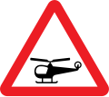
Low-flying helicopters or sudden helicopter noise
Risk of falling or fallen rocks
Traffic queues likely ahead
Traffic queues likely ahead
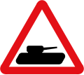
Slow-moving military vehicles likely to be in or crossing the road
Slow-moving vehicles ahead
Plate for "slow-moving vehicles" to show distance over which slow lorries extends
Plate used with "ice". may be varied to "snowdrifts"
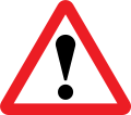
Other danger ahead. This sign must be accompanied by an information plate specifying the nature of the danger.
Fire station ahead, STOP when lights show. "FIRE" may be varied to "AMBULANCE"
Plate indicates nature of the hazard
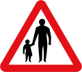
Pedestrians in road for distance shown
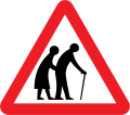
Frail pedestrians likely to cross
Disabled pedestrians. "Disabled" may be varied to "Blind"
Children going to or from school
Plate used with "school" sign
Alternative plates used with "school" sign
Alternative plates used with "school" sign
Alternative plates used with "school" sign
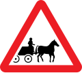
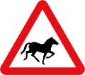
Accompanied horses or ponies likely to be in or crossing the road
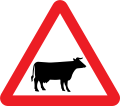
Area infected by animal disease
Plate used with "cattle grid" for indication of bypass for horse-drawn vehicles and animals
Plate used with "cattle" to indicate supervised cattle crossing ahead
Trams likely to be crossing ahead
Regulatory signs[edit]
Signs in circular red borders are prohibitive, whether or not they also have a diagonal red line. Circular blue signs mainly give a positive (mandatory) instruction. Such circular signs may be accompanied by, or place on, a rectangular plate (information) that provides details of the prohibition or instruction; for example, waiting and loading plates and zone entry signs.
'Stop' signs (octagonal) and 'give way' signs (inverted triangle) are the two notable exceptions, the distinctive shapes being recognisable even if the face is obscured by dirt or snow.
Stop before crossing the traverse line on the road and ensure the way is clear before entering a major road
Give way to traffic on the major road (English Language Only)
Give way to traffic on the major road (English and Welsh Language)
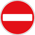
No Entry for vehicular traffic. An exception plate may not accompany this sign
All vehicles prohibited. An exception plate may not accompany this sign
Plate for "vehicles prohibited", during the time indicated except for access
Plate for "vehicles prohibited", all vehicles prohibited from 'Play Street' during the period indicated except for access
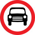
Motor vehicles prohibited (that is: excluding non-mechanically propelled vehicles being pushed by pedestrians). This sign may additionally display an exception plate (for example: 'Except Buses')
Motor vehicles except solo motorcycles prohibited. This sign may additionally display an exception plate (for example: 'Except for access')
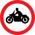
Solo motorcycles prohibited. This sign may additionally display an exception plate (for example: 'Except for access')
Towed caravans prohibited
Ridden or accompanied horses prohibited
Horse-drawn vehicles prohibited. This sign may additionally display an exception plate (for example: 'Except for access')
Articulated vehicles prohibited
Goods vehicles exceeding an unladen weight of 7.5 t prohibited. This sign may additionally display an exception plate (for example: 'Except for access').
End of prohibition of goods vehicles exceeding the maximum unladen weight indicated in a previous sign
Vehicles exceeding length indicated prohibited (metric). This sign may additionally display an exception plate (for example: 'Except for access')
Vehicles exceeding length indicated prohibited (imperial). This sign may additionally display an exception plate (for example: 'Except for access')
Vehicles carrying explosives (such as fireworks) prohibited. This sign is not actually in the regulations but separately approved by the DoT.
Additional plate required on "prohibited: vehicles carrying explosives" sign because the sign is not included in the TSRGD
Vehicles exceeding width indicated prohibited (imperial and metric) This sign may additionally display an exception plate (for example: 'Except Buses')
Vehicles exceeding height indicated prohibited (imperial and metric)
Vehicles exceeding a gross weight of 33 t prohibited from crossing the bridge or structure. The exception plate is optional, but this is the only exception permitted.
Exception plate for use only with specified regulation signs giving exception for access to premises or land adjacent to the road, where there is no other route. Other exceptions may be shown
Except for loading and unloading by goods vehicles
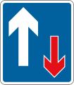
Priority must be given to vehicles from the opposite direction
Priority must be given to vehicles from the opposite direction (supplementary panel)
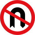
No U-turns for vehicular traffic
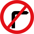
No right turn for vehicular traffic
No left turn for vehicular traffic
Stop, children crossing ahead (This sign can only be displayed by a person at a patrolled crossing).
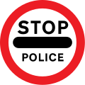
Stop before crossing, Police ahead
Combines the three prohibitions shown, specifies to where it applies and adds the additional prohibition of animals. The word 'animals' and/or the prohibited pedestrians sign may be omitted
Vehicular traffic must turn left (right if symbol reversed)
Vehicular traffic must turn ahead in the direction indicated by the arrow
Vehicular traffic passing the sign must keep to the left of the sign (right if symbol reversed)
Mini-roundabout (give way to traffic from the immediate right)
End of controlled or voucher parking zone
Speed Limit Signs[edit]
The United Kingdom national speed limit for cars and motorcycles is 70 miles per hour on a motorway and dual carriageway, and 60 miles per hour on a single carriageway road. In urban areas where there is electric street lighting the speed limit is 30 miles per hour unless otherwise signed.[15][16]
Maximum speed limit of 40 miles per hour
National speed limit applies
Entrance to a 20 miles per hour speed limit zone
End of 20 miles per hour zone
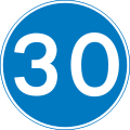
Minimum speed limit of 30 miles per hour
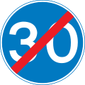
End of 30 miles per hour minimum speed limit
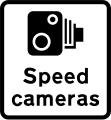
Speed camera ahead with reminder of 30 miles per hour speed limit
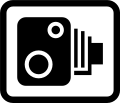
Area in which cameras are used to enforce the speed limit regulations
National speed limits (Northern Ireland Only)
Low Bridge Signs[edit]
Bridges with a clearance of less than 16 feet 7 inches (5.05 m) are normally signed. Signs were formerly only in feet and inches, but from 2015 new or replacement signs must contain both imperial and metric measurements. The signs used at a low bridge depend on the type above the road. If a beam bridge with a horizontal clearance, the roundel is used and the limit is a prohibition. However if the bridge is an arch over the road, warning signs are used as the height varies across the width of the carriageway. Bridges particularly at risk from strikes may have a variable message sign that is activated by high vehicles passing through an infra-red beam. When the sign is activated four amber lamps flash, the top pair alternating with the bottom pair.
Warning of maximum headroom of arch bridge/overhanging structure some distance ahead (sign also used at the bridge itself)
Supplementary plate informing height limit warning is of an overhanging building
Warning of maximum headroom of arch bridge directly ahead (metric)
Warning of maximum headroom of arch bridge directly ahead (imperial)
Supplementary plate used with arch bridge warning signs
Height restriction (metric and imperial)
Level crossing Signs[edit]
Some level crossings in the United Kingdom do not have gates or barriers. These crossings will have several signs posted on approach and at the crossing.
Level crossing with gate or barrier ahead
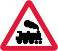
Railway level crossing without gate or barrier ahead
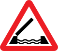
Warning of light signals at a level crossing ahead (the sign may also be used at a lifting bridge or airfield)
Electrified overhead cable ahead
Supplementary plate informing height of overhead cables at level crossing ahead
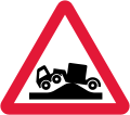
Risk of grounding at level crossing ahead
Information sign for large vehicles informing to phone at automatic level crossing
Information sign for very large vehicles to phone before crossing railway
Direction to telephone at level crossing
Telephone at level crossing
Countdown marker to level crossing (3)
Countdown marker to level crossing (2)
Countdown marker to level crossing (1)
Supplementary plate warning drivers to not block the level crossing
Supplementary plate at multiple track automatic level crossings warning of a second train
Bus and cycle signs[edit]
Some roads and pavements are shared with cyclists and buses. The word "local" on the bus symbol means the only buses that may use the lane are those running a local service. Where the word "local" is not shown, the lane may be used by any vehicle designed to carry more than eight passengers, excluding the driver, and local buses. Solo motorcycles may use the lane where the motorcycle symbol is shown on the signs. Other vehicles may enter and stop in a bus lane to load and unload unless signs alongside the lane indicate otherwise.
Buses prohibited. This sign may additionally display an exception plate (for example: 'Except for access')
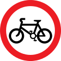
Riding of pedal cycles prohibited. Schedule 5 of the traffic signs regulations specifically states that the use of this sign is not backed by any legislation[17]
(Undivided) shared path route for cyclists and pedestrians only
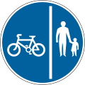
Divided track for cyclists and pedestrians only
Route for use by pedal cycles only
Route for use by tramcars only
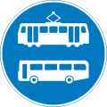
Route for use by buses and tramcars only
Route recommended for pedal cycles on the main carriageway of a road
Junction ahead leading to a parking place for pedal cycles
Bus lane with traffic proceeding from both ways (reminder for pedestrians)
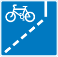
With-flow cycle lane ahead
Parking place for buses only during the times shown
Contra-flow bus lane which pedal cycles may also use with traffic approaching from the right (reminder for pedestrians)
Pedestrian zone signs[edit]
Areas such as high streets and shopping areas may be signed as "pedestrian zones". Restrictions are detailed on zone entry signs and repeater plates. The entry signs may indicate that buses, taxis, disabled badge holders or permit holders may enter the zone. Examples of zone entry signs include:
Entry to and waiting in pedestrian zone restricted except for loading during the period
End of restrictions associated with a pedestrian zone
Waiting restriction repeater signs within the pedestrian zone
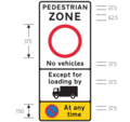
No vehicles allowed in pedestrian zone except for lorries during the period with no waiting at any time
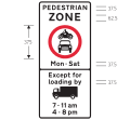
No vehicles allowed between 7am & 11am and between 4pm and 8pm on Mondays to Saturdays only in pedestrian zone except for loading from lorries
Loading bays and Parking signs[edit]
Both signs and road markings indicate waiting restrictions. On-street parking places may be designated for a particular class of vehicle (e.g. solo motorcycles or car) or a specific type of user (e.g. permit holders or disabled badge holders). Parking may be free or paid for (e.g. "pay and display" or parking meters).
There may be a time limit on the period of stay and a minimum time before returning to a particular parking place. Where a plate does not indicate the days of the week, the restrictions apply at the same times on every day, including Sunday. Where the time of day is not shown, the controls apply for 24 hours. If a bank holiday falls on a day when the controls are in operation, the controls apply in the normal way unless the plate states that they do not. Special restrictions may apply on days when a large event is being held.
Waiting prohibited except for loading and unloading during the period indicated
Waiting prohibited except for loading and unloading during the period and in the direction indicated
Waiting prohibited in designated off-highway loading area during the period indicated
Continuous prohibition on loading and unloading
Bay reserved for loading and unloading only
Waiting prohibited in the direction indicated (upper panel), and loading and unloading prohibited in the direction indicated (lower panel)
Parking place reserved for disabled badge holders only
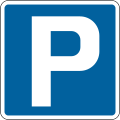
Parking for all vehicles, with restrictions on length of waiting time and return period (not necessarily free, though the sign must state if not free)
Parking place reserved for voucher parking during the period indicated
Direction to a parking place available only on the day specified
Vehicles may be parked partially on the verge or footway
Vehicles may be parked wholly on the verge or footway
End of an area where vehicles may be parked partially on the verge or footway
Motorway signs[edit]
For use on busy motorways and other wide roads where verge mounted signs would be frequently obstructed by other traffic.[18]
An advance direction sign (ADS)[18] generally has blue, green or white as its background colour to indicate the status of a road (motorway, primary or non-primary) on which it is placed. Except on the main carriageway of a motorway, coloured panels are used to indicate routes from the junction being signed that have a different status. A direction sign (DS)[18] should always be a single colour indicating the status of the road to be joined, although there are a few rare exceptions to this rule.
The Heavy and Medium typefaces were designed to compensate for the optical illusion that makes dark lines on pale backgrounds appear narrower than pale lines on dark backgrounds. Hence destinations are written in mixed case white Transport Medium on green and blue backgrounds, and in black Transport Heavy on white backgrounds. Route numbers are coloured yellow when placed directly on a green background. Some signs logically show the closest destination on the route first (i.e., on top), while others show the most distant settlement first. On a roundabout DS, the route locations are usually listed with the closest destination at the bottom and the furthest away at the top when going straight ahead, and likewise going left and right. However, many left-right signs more logically indicate the closest destination at the top with further afield destinations listed in descending order.
Destinations and roads which cannot be directly accessed on a driver's current actual route, but can be accessed via an artery route of that carriageway, are displayed in brackets.
All types of ADS (but not DS) may optionally have the junction name at the top of the sign in capital letters in a separate panel.
A route confirmatory sign is placed either after a junction where distances were not shown on the ADS or DS or is placed on an overhead information sign but does not show distances to the destinations along that route.[19]
End of motorway regulations, including the national speed limit in 1 mile
Start of motorway regulations, including the national speed limit
Number of route reached from a motorway exit road
10 miles to the next motorway service area
Junction ahead with another motorway
Entrance to motorway service area, or similar facility within the length of a motorway where motorway regulations cease to apply
Motorway junction ahead, displaying the route number and destination reached by taking this route
Route number of the motorway with destinations and distances to places along or reached from that route
Direction to a motorway at the junction shown, indicating route number and destination reached
Entrance to a motorway service area
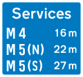
Availability of motorway service areas ahead with distances
Availability of motorway service areas ahead with distances and names of operators
Additional traffic lane joining from the left ahead (right if reversed)
Motorway Signals[edit]
Motorway conditions
Leave motorway at next exit
Risk of Fog ahead. Proceed with caution
Risk of Ice ahead. Proceed with caution
End of temporary restrictions
Temporary Speed Advisories
Temporary Speed advised of 50 mph due to prevailing traffic or weather conditions.
Lane Restrictions
Lane 2 is closed ahead. Use lane 1 and proceed with caution.
Lane 2 and 3 closed ahead. Use lane 1 and proceed with caution.
Lane 1 closed. Use lanes 2, 3 and 4, Proceed with caution
Motorway Closed
Do not enter the traffic lane directly below[a]
Both lanes closed. Do not enter the motorway when the red lamps are flashing in pairs from side to side
All 3 lanes closed Do not enter the motorway when the red lamps are flashing in pairs from side to side
All 4 lanes closed. Do not enter the motorway when the red lamps are flashing in pairs from side to side
- ^ A previous signal may direct you into an adjacent lane. More than one lane may be closed to traffic. If all lanes display a red cross, the motorway ahead is closed. Motorists caught using the traffic lane are subject to a fine of £100 and will receive points on their licence.[20]
Directional road signs[edit]
The term "directional sign" covers both Advance Direction Signs (ADS), placed on the approach to a junction,[18] and Direction Signs (DS) at the junction itself, showing where to turn.[18] A DS has a chevron (pointed) end, and this type is also referred to as a flag-type sign.[19]
300 yards to a roundabout or the next point at which traffic may leave a primary route
200 yards to a roundabout or the next point at which traffic may leave a primary route
100 yards to a roundabout or the next point at which traffic may leave a primary route
Junction ahead of a primary route with a non-primary route through a town or village that has been by-passed
Additional traffic lanes joining from the right ahead. Traffic in the right-hand lane joins the main carriageway. Traffic on the main carriageway has priority over joining traffic (primary route)
Additional traffic lane joining from the left in 200 yards. Traffic on the main carriageway had priority over joining traffic from the right-hand lane of the slip road (primary routes)
Tourist Destinations[edit]
Camping and caravan site 300 yards ahead
Steam railway tourist attraction 300 yards ahead
Picnic area 150 yards ahead
Direction to tourist attraction indicated by a symbol
Direction along a route passing through places of interest recognised by a regional tourist
Direction and distance to a picnic area
Direction and distance to a Tourist Information point or centre
Junction ahead from a motorway exit slip road to the tourist attractions shown
Direction of the route to a tourist attraction for pedestrians
Junction ahead leading to a tourist attraction
Youth hostel 200 yards in the direction indicated
Junction ahead from a motorway exit slip road to the tourist attractions shown
Historic castle tourist attraction 10 miles ahead
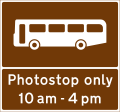
Stopping place for buses used for carrying tourists to allow passengers to take photographs
Motorway junction ahead leading to a town or geographical area containing several tourist attractions and a Tourist Information Point or Centre
Distance ahead to a parking place with a Tourist Information Point, picnic site, public telephone, public toilets and viewpoint
Diversion routes[edit]
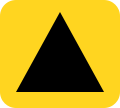
Diversion routes are marked with black symbols on a yellow patch (square, triangle, circle, or diamond). These mark diversionary routes in the event that the road ahead is closed for any reasons. Motorists can navigate following the symbol and can find their way back to the original road at a junction above the closure. The four symbols may be a solid shape or just outlines. They are most commonly placed on directional signs, following the route number (e.g. A 25) but may be free standing.
Motorway exits have trigger signs that are normally covered. In the event of a closure, the sign is uncovered and will say, for instance, "To rejoin M6 follow (symbol)". Following the symbol will allow rejoining at a later junction.[21]
On minor roads a simple black on yellow sign with an arrow and the word Diversion is used, as here.
Solid Circle - Emergency diversion route for motorway and other main road traffic
Solid Triangle - Emergency diversion route for motorway and other main road traffic
hollow Square - Emergency diversion route for motorway and other main road traffic
hollow Diamond - Emergency diversion route for motorway and other main road traffic
Diversion trigger sign - Main road closed, follow diversion to arrive at the same location
For triangle diversion, turn right
Diversion sign on minor roads or for road works starting to left.
Information signs[edit]
Informational signs are usually rectangular and generally blue with white text.
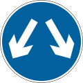
Pass either side to reach same destination (often incorrectly used to mean pass either side)[22][23]
Traffic has priority over vehicles coming from the opposite direction
Unsuitable for heavy goods vehicles
Unsuitable for long vehicles
No hard shoulder for 400 yards
Location of weight restriction ahead with indication of an alternative route (may show a different restriction or that the restriction is gross weight rather than unladen weight)
Roadworks and temporary signs[edit]
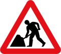
Roadworks are normally signalled with a triangular, red-bordered warning format is used to indicate that there are works ahead. The graphic is of a man digging. Within the roadworks, diversions and other instructions to drivers are normally given on yellow signs with black script.[24]
Restrictions apply. No vehicles over width shown
Diversion for motorists travelling to destination
Temporary Advisory speed limit in miles per hour
Get in Lane. HGV use left lane, all other vehicles use right lane
Street name signs[edit]
Legally street name signs are not defined as traffic signs in the United Kingdom; this therefore gives authorities flexibility on the design and placement of them. They can be fixed to a signpost, wall, lamp column, or building. The text can be in many different fonts but normally either the Transport typeface used on road signs or the serif font designed by David Kindersley. In many areas, the sign will also show the name of the local authority, its coat of arms, or part of the street’s postcode.
Location identifiers[edit]
Numbered location markers of one type or another are used to identify specific locations along a road. Historically, milestones were used, but since the early 20th century they fell into disuse. However, for administrative and maintenance purposes, distance marker posts and driver location signs have been erected on motorways and certain dual carriageways.[25] The numbers on distance marker posts are embedded into emergency roadside telephone numbers and are used by the emergency services to pinpoint incidents.[26] The advent of the mobile phone meant that drivers were not accessing location information embedded into motorway emergency telephone systems, and since 2007 driver location signs have been erected on many motorways. These contain important information about the location and carriageway direction.
Traffic lights[edit]
Standard with no right turn
Retired signs (post-Worboys)[edit]
Crossroads ahead (until 1975)
T-junction ahead (until 1975)
Side road ahead (until 1975)
Staggered crossroads ahead (until 1975)
Series of bends ahead (until 1975). This sign is rarely still used today (for sharp/dangerous bends)
Lorries prohibited (until 1975)
Buses and coaches prohibited (until 1975)
Steep hill upwards ahead (replaced with % gradient in 1975)
Steep hill downwards ahead (replaced with % gradient in 1975)
Right-hand lane of a 2 lane dual carriageway closed ahead (1975-1981)
Traffic merges from the left (until 1994)
Traffic merges onto the main carriageway (until 1994)
Icy conditions may exist (until 1994)
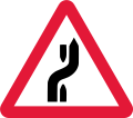
Change of carriageway ahead (1975-1994)
Vehicles and loads exceeding weight in tons indicated prohibited (1981-1994)
Stop - children crossing (until 1994)
Vehicles exceeding the indicated unladen weight in tons prohibited (replaced with tonne equivalent in 2011)
Vehicles exceeding an indicated gross weight prohibited from crossing bridge (replaced with tonne equivalent in 2011)
Vehicles exceeding width indicated prohibited (defunct imperial only sign, new signs must show both metric and imperial)
Vehicles exceeding height indicated prohibited (defunct imperial only sign, new signs must show both metric and imperial)









































































Comments
Post a Comment
If you have any doubts,please let me know